- Latest available (Revised)
- Original (As made)
The Calderdale and Kirklees (Metropolitan Borough Boundaries) Order 1993
You are here:
- UK Statutory Instruments
- 1993 No. 850
- Explanatory Note

What Version
Opening Options
More Resources
Status:
This is the original version (as it was originally made). This item of legislation is currently only available in its original format.
Explanatory Note
(This note is not part of the Order)
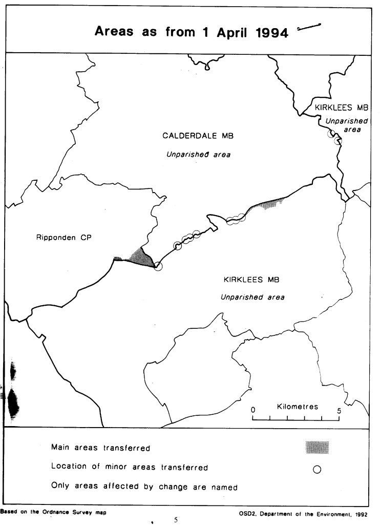
This Order transfers small areas between the metropolitan boroughs of Calderdale and Kirklees in West Yorkshire.
Consequential changes are made to wards of those boroughs and to the boundaries of petty sessional divisions.
The map and list forming part of this note (page 5) give a general guide to the changes made.
Prints of the detailed order maps (described in article 2) may be inspected at all reasonable times at the offices of the council for each metropolitan borough affected, and also at the offices of the Secretary of State for the Environment located in 2, Marsham Street, London SW1P 3EB.
In approximate terms, the land transferred from Calderdale to Kirklees has a total area of 70 hectares, and a population of 110, and that transferred from Kirklees to Calderdale a total area of 120 hectares, and a population of 67.
The Local Government Area Changes Regulations 1976 (S. I. 1976/246, amended by S. I. 1978/247) contain general provisions regarding the effect of orders such as this one.
LIST SUMMARISING CHANGES EFFECTED
1. At Upper Firth House Mills, boundary is realigned to the north side of the M62 carriageway, uniting the Mills in Calderdale.
2. At Scammonden, an area of land south of the M62 motorway and to the north west of Royal Ings is transferred to Kirklees.
3. At Glenden Works, Outlane, there is a minor realignment of boundary to unite the Works in Kirklees.
4. At Burcote Drive, Outlane, there are minor realignments to unite the Drive in Kirklees.
5. At Gees Garage, Outlane, there is a realignment to place the whole of the Garage in Kirklees.
6. Lee Hill Farm, Outlane, is transferred to Calderdale, and the boundary realigned to place the whole of the nearby motorway intersection in Kirklees.
7. Minor realignments are made at Ainley Top along the A643 road.
8. Realignments to follow northern line of the M62 in vicinity of Cote Lane, Clough Lane and Toothill Lane South.
9. At Windy Bank Farm, Hartshead, a realignment to unite the Farm in Kirklees.
10. At Highmoor Lane, Hartshead Moor, a realignment to unite No. s 65 and 67 in Kirklees.
Options/Help
Print Options
PrintThe Whole Instrument
PrintThis Explanatory Note only

Legislation is available in different versions:
Latest Available (revised):The latest available updated version of the legislation incorporating changes made by subsequent legislation and applied by our editorial team. Changes we have not yet applied to the text, can be found in the ‘Changes to Legislation’ area.
Original (As Enacted or Made): The original version of the legislation as it stood when it was enacted or made. No changes have been applied to the text.
Opening Options
Different options to open legislation in order to view more content on screen at once
More Resources
Access essential accompanying documents and information for this legislation item from this tab. Dependent on the legislation item being viewed this may include:
- the original print PDF of the as enacted version that was used for the print copy
- lists of changes made by and/or affecting this legislation item
- confers power and blanket amendment details
- all formats of all associated documents
- correction slips
- links to related legislation and further information resources
 All content is available under the Open Government Licence v3.0 except where otherwise stated. This site additionally contains content derived from EUR-Lex, reused under the terms of the Commission Decision 2011/833/EU on the reuse of documents from the EU institutions. For more information see the EUR-Lex public statement on re-use.