- Latest available (Revised)
- Original (As made)
The Greater London and Kent (County Boundaries) Order 1992
You are here:
- UK Statutory Instruments
- 1992 No. 2090
- Explanatory Note

What Version
Opening Options
More Resources
Status:
This is the original version (as it was originally made). This item of legislation is currently only available in its original format.
Explanatory Note
(This note is not part of the Order)
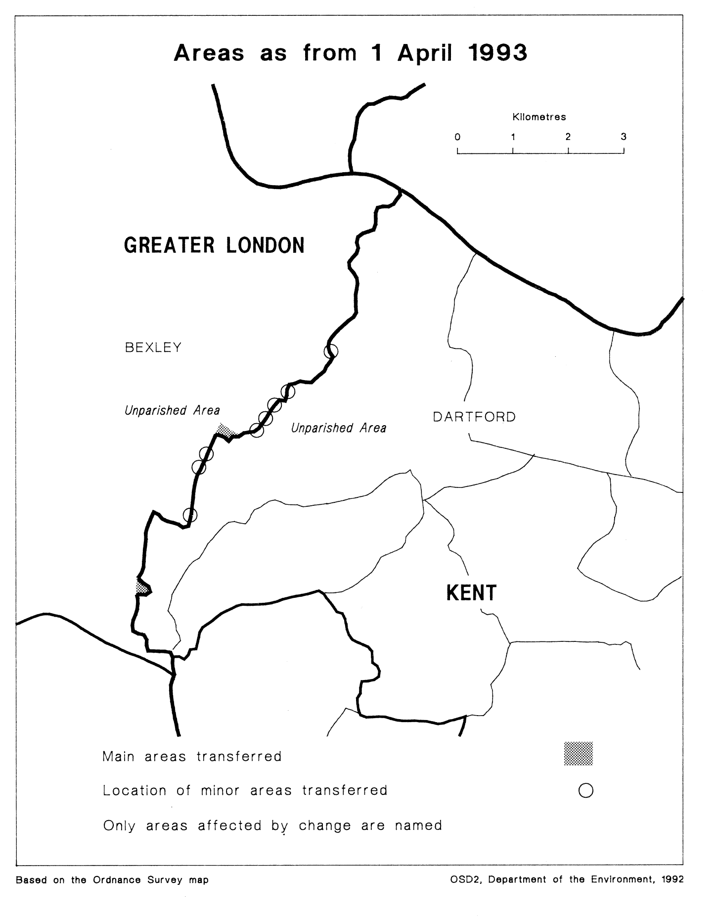
This Order transfers areas between Greater London and Kent, affecting the boundaries of the London borough of Bexley, and of the Kent borough of Dartford. Consequential local government electoral areas, petty sessional divisions and coroners' districts are made.
The map and table forming part of this note (Pages 5 and 6) give a general guide to the areas transferred. In approximate terms, the total area of land transferred from Greater London to Kent is 15 hectares (population of 30), and that transferred from Kent to Greater London, 5 hectares (population of 70). Prints of the detailed maps (described in article 2) may be inspected at all reasonable times at the offices of the council for each borough affected, and additionally at the offices of the Secretary of State for the Environment located in 2, Marsham Street, London SW1P 3EB.
The Local Government Area Changes Regulations 1976 contain general provisions regarding the effect of orders such as this one.
TABLE
| Main transfer from Greater London (Bexley) to Kent (Dartford) | Area of open land in the vicinity of the River Cray/Stanham River/Thames Road, lying to the east of the depot. |
|---|---|
| Main transfers from Kent (Dartford) to Greater London (Bexley) | 1. Area of open land west of Hillcrest Road and north of Rochester Way, including the site of the former Gun Club. 2. Transfer of area of woodland at Joyden’s Wood/Chalk Wood. 3. Transfer of residential area, affecting Tile Kiln Lane, Wicksteed Close and Staple Close, and open land to the south of Staple Close. |
| Minor realignments in the following areas— | 1. Maiden Lane/Crayford Road/North Road/Chastilian Road. 2. In vicinity of East Rochester Way and Denton Road. |
Options/Help
Print Options
PrintThe Whole Instrument
PrintThis Explanatory Note only

Legislation is available in different versions:
Latest Available (revised):The latest available updated version of the legislation incorporating changes made by subsequent legislation and applied by our editorial team. Changes we have not yet applied to the text, can be found in the ‘Changes to Legislation’ area.
Original (As Enacted or Made): The original version of the legislation as it stood when it was enacted or made. No changes have been applied to the text.
Opening Options
Different options to open legislation in order to view more content on screen at once
More Resources
Access essential accompanying documents and information for this legislation item from this tab. Dependent on the legislation item being viewed this may include:
- the original print PDF of the as enacted version that was used for the print copy
- lists of changes made by and/or affecting this legislation item
- confers power and blanket amendment details
- all formats of all associated documents
- correction slips
- links to related legislation and further information resources
 All content is available under the Open Government Licence v3.0 except where otherwise stated. This site additionally contains content derived from EUR-Lex, reused under the terms of the Commission Decision 2011/833/EU on the reuse of documents from the EU institutions. For more information see the EUR-Lex public statement on re-use.