(This note is not part of the Order)
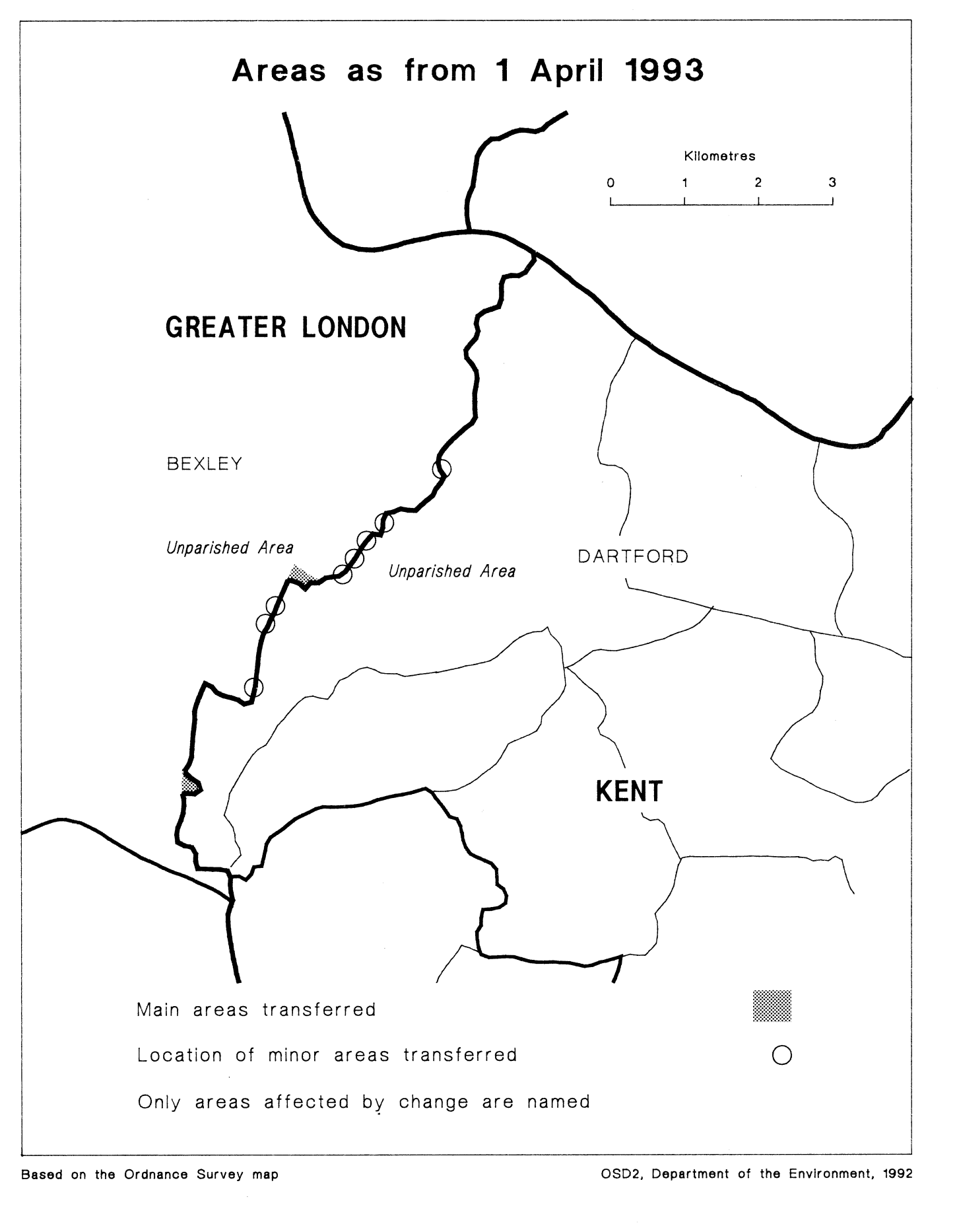
This Order transfers areas between Greater London and Kent, affecting the boundaries of the London borough of Bexley, and of the Kent borough of Dartford. Consequential local government electoral areas, petty sessional divisions and coroners' districts are made.
The map and table forming part of this note (Pages 5 and 6) give a general guide to the areas transferred. In approximate terms, the total area of land transferred from Greater London to Kent is 15 hectares (population of 30), and that transferred from Kent to Greater London, 5 hectares (population of 70). Prints of the detailed maps (described in article 2) may be inspected at all reasonable times at the offices of the council for each borough affected, and additionally at the offices of the Secretary of State for the Environment located in 2, Marsham Street, London SW1P 3EB.
The Local Government Area Changes Regulations 1976 contain general provisions regarding the effect of orders such as this one.
Main transfer from Greater London (Bexley) to Kent (Dartford) | Area of open land in the vicinity of the River Cray/Stanham River/Thames Road, lying to the east of the depot. |
|---|---|
Main transfers from Kent (Dartford) to Greater London (Bexley) |
|
Minor realignments in the following areas— |
|