EXPLANATORY NOTE
(This note is not part of the Regulations)
These Regulations make provision for relief from liability to non-domestic rates for lands and heritages located on islands in Scottish waters and in certain remote areas in Scotland, and operating in specified areas of the hospitality sector, for the financial year 2024-25.
Regulation 3 makes provision for how an application to obtain the relief in regulation 4 must be made.
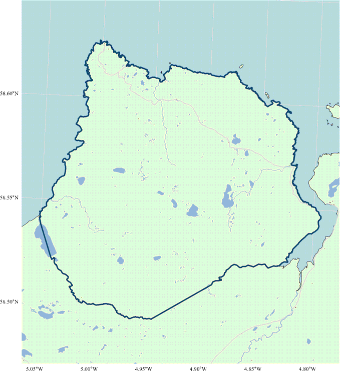
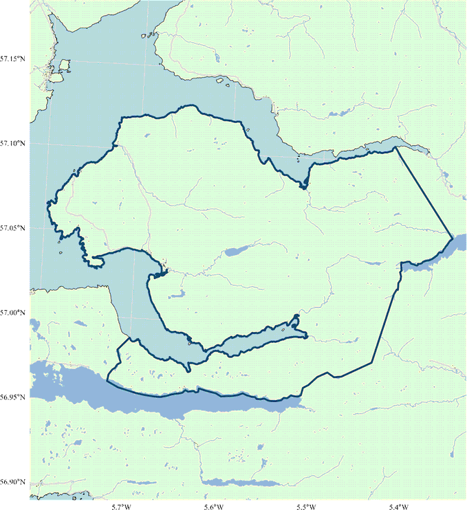
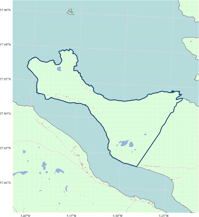
Regulation 4 provides for relief in respect of lands and heritages wholly or mainly used for one or more of the purposes specified in schedule 2 that are situated on an island (as defined in regulation 2) or in an area falling within the boundaries described in schedule 1. The boundaries in schedule 1 are described using Ordnance Survey National Grid references, along with a topographical description of the course of the boundary between each grid reference. Together these boundaries enclose the three areas in question.
The areas form part of peninsulas, namely Cape Wrath, Knoydart and Scoraig. which are not accessible via the public road network. Illustrative maps of the areas falling within the boundaries accompany this explanatory note. Copies are also available for inspection at the Scottish Government Local Government and Analytical Services Division, Victoria Quay, Edinburgh, EH6 6QQ.
Regulation 4(2), as read with regulation 4(1), provides that 100% relief is granted for the financial year 2024-25, with the qualification in regulation 4(3) that the relief may not reduce the rates liability of any particular ratepayer by more than £110,000.
This map depicts the area described in part 1 of schedule 1 (Cape Wrath) for illustrative purposes only and has no legal effect.
Reproduced by permission of Ordnance Survey on behalf of HMSO. © Crown copyright and database right 2024. All rights reserved. Ordnance Survey Licence number 100024655.
This map depicts the area described in part 2 of schedule 1 (Knoydart) for illustrative purposes only and has no legal effect.
Reproduced by permission of Ordnance Survey on behalf of HMSO. © Crown copyright and database right 2024. All rights reserved. Ordnance Survey Licence number 100024655.
This map depicts the area descried in part 3 of schedule 1 (Scoraig) for illustrative purposes only and has no legal effect.
Reproduced by permission of Ordnance Survey on behalf of HMSO. © Crown copyright and database right 2024. All rights reserved. Ordnance Survey Licence number 100024655.