- Y Diweddaraf sydd Ar Gael (Diwygiedig)
- Gwreiddiol (a wnaed Fel)
The Scottish Adjacent Waters Boundaries Order 1999
You are here:
- Offerynnau Statudol y Deyrnas Unedig
- 1999 No. 1126
- Whole Instrument
- Blaenorol
- Nesaf

Pa Fersiwn
Rhagor o Adnoddau
Status:
Dyma’r fersiwn wreiddiol (fel y’i gwnaed yn wreiddiol). This item of legislation is currently only available in its original format.
Statutory Instruments
1999 No. 1126
CONSTITUTIONAL LAW
DEVOLUTION, SCOTLAND
The Scottish Adjacent Waters Boundaries Order 1999
Made
13th April 1999
Coming into force in accordance with article 1
At the Court at Windsor Castle, the 13th day of April 1999
Present,
The Queen’s Most Excellent Majesty in Council
Whereas a draft of this Order has been laid before, and approved by a resolution of, each House of Parliament in accordance with section 115(1) of, and paragraphs 1 and 2 of Schedule 7 to, the Scotland Act 1998(1);
Now, therefore, Her Majesty, in exercise of the powers conferred upon Her by section 126(2) of the Scotland Act 1998 is pleased, by and with the advice of Her Privy Council, to order, and it is hereby ordered, as follows:
Citation and commencement
1. This Order may be cited as the Scottish Adjacent Waters Boundaries Order 1999 and shall come into force on the principal appointed day(2).
Interpretation
2. In this Order–
“co-ordinate” means a co-ordinate on the Ordnance Survey of Great Britain 1936 Datum;
“line”, in relation to any list of co-ordinates in this Order, means a loxodromic line.
Boundaries – internal waters and territorial sea
3. For the purposes of the Scotland Act 1998, the boundaries between waters which are to be treated as internal waters or territorial sea of the United Kingdom adjacent to Scotland and those which are not, shall be–
(a)off the east coast of Great Britain, a line joining the co-ordinates set out in Part I of the Schedule to this Order, and
(b)off the west coast of Great Britain a line joining,
(i)the co-ordinates set out in Section 1 of Part II of that Schedule, and then
(ii)the seaward limit of the United Kingdom territorial sea, and then
(iii)the co-ordinates set out in Section 2 of Part II of that Schedule.
Boundaries – sea within British fishery limits
4. For the purposes of the Scotland Act 1998, the boundaries between waters which are to be treated as sea within British fishery limits adjacent to Scotland and those which are not, shall be–
(a)off the east coast of Great Britain,
(i)the line referred to in article 3(a) above, and then
(ii)a line joining the co-ordinates set out in Schedule 2 to this Order.
(b)off the west coast of Great Britain,
(i)the line referred to in article 3(b) above, and then
(ii)the seaward limit of the United Kingdom territorial sea adjacent to Northern Ireland between the following co-ordinates–
| 55° 26' 37"N | 06° 34' 40"W, and |
| 55° 24' 54"N | 06° 44' 36"W. |
A. K. Galloway
Clerk of the Privy Council
Article 3
SCHEDULE 1BOUNDARIES – INTERNAL WATERS AND TERRITORIAL SEA
PART IBOUNDARY OFF THE EAST COAST OF GREAT BRITAIN
| 1. | 55° 48' 42"N | 02° 01' 54"W |
| 2. | 55° 49' 47"N | 01° 59' 58"W |
| 3. | 55° 50' 40"N | 01° 58' 09"W |
| 4. | 55° 50' 44"N | 01° 57' 55"W |
| 5. | 55° 53' 17"N | 01° 48' 28"W |
| 6. | 55° 53' 27"N | 01° 47' 54"W |
| 7. | 55° 55' 01"N | 01° 43' 32"W |
PART IIBOUNDARY OFF THE WEST COAST OF GREAT BRITAIN
Section 1
Solway Firth
| 1. | 54° 59' 05"N | 03° 03' 33"W |
| 2. | 54° 58' 18"N | 03° 04' 55"W |
| 3. | 54° 56' 59"N | 03° 08' 29"W |
| 4. | 54° 57' 41"N | 03° 10' 58"W |
| 5. | 54° 57' 39"N | 03° 14' 05"W |
| 6. | 54° 56' 22"N | 03° 20' 48"W |
| 7. | 54° 54' 34"N | 03° 27' 55"W |
| 8. | 54° 49' 11"N | 03° 32' 23"W |
| 9. | 54° 46' 44"N | 03° 38' 12"W |
| 10. | 54° 37' 50"N | 03° 50' 47"W |
Irish Sea
| 11. | 54° 37' 33"N | 03° 51' 05"W |
| 12. | 54° 36' 56"N | 03° 52' 05"W |
| 13. | 54° 36' 07"N | 03° 53' 52"W |
| 14. | 54° 33' 13"N | 04° 00' 11"W |
| 15. | 54° 32' 47"N | 04° 01' 07"W |
| 16. | 54° 31' 51"N | 04° 03' 09"W |
| 17. | 54° 30' 00"N | 04° 04' 25"W |
| 18. | 54° 30' 55"N | 04° 05' 39"W |
| 19. | 54° 33' 02"N | 04° 09' 08"W |
| 20. | 54° 33' 08"N | 04° 10' 35"W |
| 21. | 54° 33' 12"N | 04° 11' 42"W |
| 22. | 54° 33' 07"N | 04° 15' 26"W |
| 23. | 54° 33' 03"N | 04° 17' 30"W |
| 24. | 54° 32' 47"N | 04° 23' 57"W |
| 25. | 54° 32' 31"N | 04° 26' 12"W |
| 26. | 54° 32' 02"N | 04° 29' 24"W |
| 27. | 54° 31' 46"N | 04° 31' 53"W |
| 28. | 54° 31' 10"N | 04° 34' 49"W |
| 29. | 54° 30' 45"N | 04° 36' 48"W |
| 30. | 54° 29' 58"N | 04° 40' 17"W |
| 31. | 54° 29' 01"N | 04° 43' 37"W |
| 32. | 54° 27' 43"N | 04° 47' 32"W |
| 33. | 54° 26' 02"N | 04° 52' 02"W |
Section 2
| 34. | 54° 27' 52"N | 05° 04' 36"W |
| 35. | 54° 28' 13"N | 05° 05' 08"W |
| 36. | 54° 30' 37"N | 05° 07' 18"W |
| 37. | 54° 31' 56"N | 05° 08' 37"W |
| 38. | 54° 32' 15"N | 05° 08' 57"W |
| 39. | 54° 33' 57"N | 05° 10' 50"W |
| 40. | 54° 36' 22"N | 05° 12' 41"W |
| 41. | 54° 38' 13"N | 05° 13' 43"W |
| 42. | 54° 38' 27"N | 05° 13' 44"W |
North Channel
| 43. | 54° 39' 48"N | 05° 14' 37"W |
| 44. | 54° 40' 39"N | 05° 14' 33"W |
| 45. | 54° 41' 49"N | 05° 14' 49"W |
| 46. | 54° 42' 02"N | 05° 14' 53"W |
| 47. | 54° 42' 50"N | 05° 15' 33"W |
| 48. | 54° 44' 08"N | 05° 16' 48"W |
| 49. | 54° 44' 58"N | 05° 17' 37"W |
| 50. | 54° 46' 37"N | 05° 19' 38"W |
| 51. | 54° 48' 21"N | 05° 21' 50"W |
| 52. | 54° 49' 29"N | 05° 23' 21"W |
| 53. | 54° 49' 51"N | 05° 23' 48"W |
| 54. | 54° 50' 05"N | 05° 24' 11"W |
| 55. | 54° 50' 40"N | 05° 25' 05"W |
| 56. | 54° 51' 22"N | 05° 26' 05"W |
| 57. | 54° 51' 25"N | 05° 26' 08"W |
| 58. | 54° 51' 57"N | 05° 26' 28"W |
| 59. | 54° 52' 40"N | 05° 26' 51"W |
| 60. | 54° 53' 10"N | 05° 27' 07"W |
| 61. | 54° 53' 53"N | 05° 27' 24"W |
| 62. | 54° 54' 19"N | 05° 27' 23"W |
| 63. | 54° 54' 54"N | 05° 27' 44"W |
| 64. | 54° 55' 44"N | 05° 28' 21"W |
| 65. | 54° 55' 59"N | 05° 28' 32"W |
| 66. | 54° 56' 49"N | 05° 29' 13"W |
| 67. | 54° 57' 31"N | 05° 29' 53"W |
| 68. | 54° 57' 53"N | 05° 30' 10"W |
| 69. | 54° 58' 53"N | 05° 31' 05"W |
| 70. | 54° 59' 45"N | 05° 32' 00"W |
| 71. | 55° 00' 31"N | 05° 32' 58"W |
| 72. | 55° 01' 22"N | 05° 34' 12"W |
| 73. | 55° 02' 08"N | 05° 35' 29"W |
| 74. | 55° 02' 48"N | 05° 36' 47"W |
| 75. | 55° 03' 25"N | 05° 38' 13"W |
| 76. | 55° 04' 01"N | 05° 39' 47"W |
| 77. | 55° 04' 29"N | 05° 41' 15"W |
| 78. | 55° 04' 55"N | 05° 42' 53"W |
| 79. | 55° 05' 15"N | 05° 44' 21"W |
| 80. | 55° 05' 30"N | 05° 44' 37"W |
| 81. | 55° 06' 25"N | 05° 45' 46"W |
| 82. | 55° 07' 13"N | 05° 46' 51"W |
| 83. | 55° 08' 05"N | 05° 48' 13"W |
| 84. | 55° 08' 21"N | 05° 48' 41"W |
| 85. | 55° 08' 53"N | 05° 49' 03"W |
| 86. | 55° 09' 57"N | 05° 49' 54"W |
| 87. | 55° 10' 58"N | 05° 50' 50"W |
| 88. | 55° 11' 53"N | 05° 51' 50"W |
| 89. | 55° 12' 41"N | 05° 52' 48"W |
| 90. | 55° 12' 57"N | 05° 53' 11"W |
| 91. | 55° 13' 12"N | 05° 53' 33"W |
| 92. | 55° 13' 46"N | 05° 54' 29"W |
| 93. | 55° 14' 20"N | 05° 55' 08"W |
| 94. | 55° 14' 33"N | 05° 55' 25"W |
| 95. | 55° 15' 04"N | 05° 56' 10"W |
| 96. | 55° 15' 20"N | 05° 56' 35"W |
| 97. | 55° 15' 46"N | 05° 57' 20"W |
| 98. | 55° 16' 07"N | 05° 58' 02"W |
| 99. | 55° 16' 32"N | 05° 58' 56"W |
| 100. | 55° 16' 47"N | 05° 59' 32"W |
| 101. | 55° 17' 03"N | 06° 00' 15"W |
| 102. | 55° 17' 08"N | 06° 00' 27"W |
| 103. | 55° 17' 37"N | 06° 00' 46"W |
| 104. | 55° 18' 16"N | 06° 01' 16"W |
| 105. | 55° 18' 41"N | 06° 01' 38"W |
| 106. | 55° 19' 08"N | 06° 02' 04"W |
| 107. | 55° 19' 10"N | 06° 02' 07"W |
| 108. | 55° 19' 36"N | 06° 02' 34"W |
| 109. | 55° 20' 11"N | 06° 03' 18"W |
| 110. | 55° 20' 15"N | 06° 03' 24"W |
| 111. | 55° 20' 32"N | 06° 03' 47"W |
| 112. | 55° 20' 56"N | 06° 04' 25"W |
| 113. | 55° 21' 16"N | 06° 05' 02"W |
| 114. | 55° 21' 43"N | 06° 05' 57"W |
| 115. | 55° 22' 00"N | 06° 06' 34"W |
| 116. | 55° 22' 07"N | 06° 06' 54"W |
| 117. | 55° 22' 18"N | 06° 07' 22"W |
| 118. | 55° 22' 33"N | 06° 08' 06"W |
| 119. | 55° 22' 45"N | 06° 08' 45"W |
| 120. | 55° 22' 55"N | 06° 09' 12"W |
| 121. | 55° 23' 09"N | 06° 09' 53"W |
| 122. | 55° 23' 22"N | 06° 10' 40"W |
| 123. | 55° 23' 31"N | 06° 11' 13"W |
| 124. | 55° 23' 39"N | 06° 11' 38"W |
| 125. | 55° 23' 59"N | 06° 12' 41"W |
| 126. | 55° 24' 09"N | 06° 13' 16"W |
| 127. | 55° 24' 24"N | 06° 14' 19"W |
| 128. | 55° 24' 26"N | 06° 14' 24"W |
| 129. | 55° 24' 37"N | 06° 15' 16"W |
| 130. | 55° 24' 47"N | 06° 16' 12"W |
| 131. | 55° 24' 49"N | 06° 16' 23"W |
| 132. | 55° 24' 59"N | 06° 17' 16"W |
| 133. | 55° 25' 09"N | 06° 18' 18"W |
| 134. | 55° 25' 16"N | 06° 19' 12"W |
| 135. | 55° 25' 25"N | 06° 20' 28"W |
| 136. | 55° 25' 33"N | 06° 21' 58"W |
| 137. | 55° 25' 35"N | 06° 22' 34"W |
| 138. | 55° 25' 36"N | 06° 22' 53"W |
| 139. | 55° 25' 41"N | 06° 23' 57"W |
| 140. | 55° 25' 44"N | 06° 24' 54"W |
| 141. | 55° 25' 48"N | 06° 26' 52"W |
| 142. | 55° 25' 49"N | 06° 27' 39"W |
| 143. | 55° 25' 49"N | 06° 28' 39"W |
| 144. | 55° 25' 48"N | 06° 29' 56"W |
| 145. | 55° 25' 51"N | 06° 30' 11"W |
| 146. | 55° 25' 54"N | 06° 30' 25"W |
| 147. | 55° 26' 05"N | 06° 31' 23"W |
| 148. | 55° 26' 14"N | 06° 32' 11"W |
| 149. | 55° 26' 22"N | 06° 32' 57"W |
| 150. | 55° 26' 34"N | 06° 34' 15"W |
| 151. | 55° 26' 37"N | 06° 34' 40"W |
Article 4
SCHEDULE 2BOUNDARY – SEA WITHIN BRITISH FISHERY LIMITS
| 1. | 55° 55' 01'N | 01° 43' 32'W |
| 2. | 55° 56' 00'N | 01° 40' 35'W |
| 3. | 55° 56' 30'N | 01° 38' 54'W |
| 4. | 55° 58' 01'N | 01° 33' 49'W |
| 5. | 56° 01' 54'N | 01° 26' 02'W |
| 6. | 56° 11' 41'N | 01° 11' 20'W |
| 7. | 56° 22' 16'N | 00° 55' 04'W |
| 8. | 56° 23' 39'N | 00° 50' 28'W |
| 9. | 56° 27' 10'N | 00° 38' 41'W |
| 10. | 56° 27' 40'N | 00° 35' 11'W |
| 11. | 56° 30' 12'N | 00° 17' 09'W |
| 12. | 56° 32' 41'N | 00° 01' 51'E |
| 13. | 56° 33' 38'N | 00° 13' 13'E |
| 14. | 56° 34' 39'N | 00° 26' 10'E |
| 15. | 56° 36' 13'N | 00° 47' 53'E |
| 16. | 56° 36' 26'N | 00° 57' 24'E |
| 17. | 56° 36' 32'N | 01° 10' 34'E |
| 18. | 56° 36' 37'N | 01° 30' 00'E |
| 19. | 56° 36' 39'N | 02° 00' 00'E |
| 20. | 56° 36' 33'N | 02° 30' 00'E |
| 21. | 56° 36' 31'N | 02° 36' 26'E |
Explanatory Note
(This note is not part of the Order)
This Order describes for the purposes of the Scotland Act 1998–
(a)the boundaries between waters which are to be treated as internal waters or territorial sea of the United Kingdom adjacent to Scotland and those which are not (article 3) and
(b)the boundaries between waters which are to be treated as sea within British fishery limits adjacent to Scotland and those which are not (article 4).
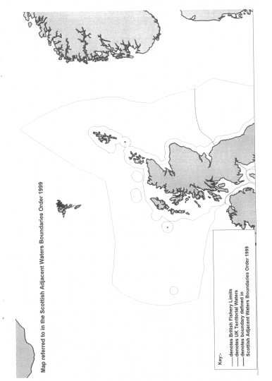
A map showing the line of the boundaries for illustrative purposes only is appended to this note.
(1)
(2)
The pricipal appointed day is 1st July 1999 by virtue of article 3 of the Scotland Act 1998 (Commencement) Order 1998 (S.I. 1998/3178)
Options/Help
Print Options
PrintThe Whole Instrument

Mae deddfwriaeth ar gael mewn fersiynau gwahanol:
Y Diweddaraf sydd Ar Gael (diwygiedig):Y fersiwn ddiweddaraf sydd ar gael o’r ddeddfwriaeth yn cynnwys newidiadau a wnaed gan ddeddfwriaeth ddilynol ac wedi eu gweithredu gan ein tîm golygyddol. Gellir gweld y newidiadau nad ydym wedi eu gweithredu i’r testun eto yn yr ardal ‘Newidiadau i Ddeddfwriaeth’.
Gwreiddiol (Fel y’i Deddfwyd neu y’i Gwnaed): Mae'r wreiddiol fersiwn y ddeddfwriaeth fel ag yr oedd pan gafodd ei deddfu neu eu gwneud. Ni wnaed unrhyw newidiadau i’r testun.
Dewisiadau Agor
Dewisiadau gwahanol i agor deddfwriaeth er mwyn gweld rhagor o gynnwys ar y sgrin ar yr un pryd
Rhagor o Adnoddau
Gallwch wneud defnydd o ddogfennau atodol hanfodol a gwybodaeth ar gyfer yr eitem ddeddfwriaeth o’r tab hwn. Yn ddibynnol ar yr eitem ddeddfwriaeth sydd i’w gweld, gallai hyn gynnwys:
- y PDF print gwreiddiol y fel deddfwyd fersiwn a ddefnyddiwyd am y copi print
- rhestr o newidiadau a wnaed gan a/neu yn effeithio ar yr eitem hon o ddeddfwriaeth
- manylion rhoi grym a newid cyffredinol
- pob fformat o’r holl ddogfennau cysylltiedig
- slipiau cywiro
- dolenni i ddeddfwriaeth gysylltiedig ac adnoddau gwybodaeth eraill
 Mae’r holl gynnwys ar gael dan Drwydded Llywodraeth Agored v3.0 ac eithrio ble nodir yn wahanol. Yn ychwanegol mae’r safle hwn â chynnwys sy’n deillio o EUR-Lex, a ailddefnyddiwyd dan delerau Penderfyniad y Comisiwn 2011/833/EU ar ailddefnyddio dogfennau o sefydliadau’r UE. Am ragor o wybodaeth gweler ddatganiad cyhoeddus Swyddfa Gyhoeddiadau’r UE ar ailddefnyddio.