Explanatory Note
(This note is not part of the Order)
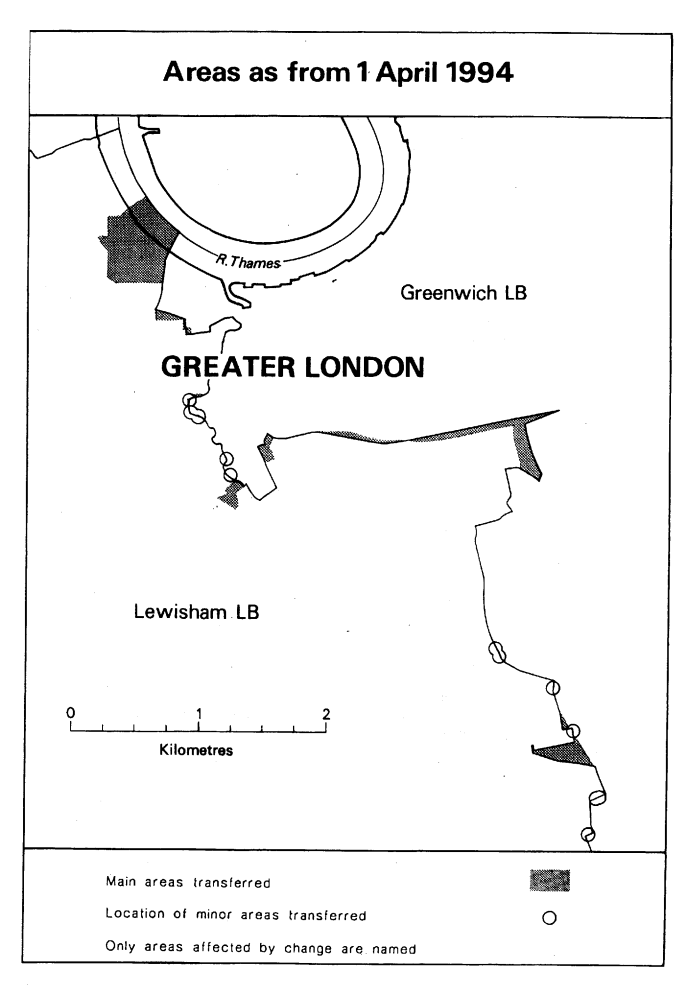
This Order makes changes to the boundary between the London boroughs of Greenwich and Lewisham.
The map and table at the end of this Note give a general guide to the areas affected and the changes made.
The table also gives an approximate figure for the total area of land involved (in hectares), and for the population affected.
For full details of the transfers made, the order maps (described in article 2) should be inspected.
Any person may inspect them at any reasonable time at the offices of the council for each London borough affected, and also at the offices of the Secretary of State for the Environment located in 2, Marsham Street, London SW1P 3EB.
The Local Government Area Changes Regulations 1976 (S. I. 1976/246, amended by S. I. 1978/247) contain general provisions regarding the effect of orders such as this one.
TABLE
TOTAL AREA AND POPULATION TRANSFERRED (Approximate)
| From Greenwich to Lewisham— | |
| Area: 40 hectares | Population: 870 |
| From Lewisham to Greenwich— | |
| Area: 10 hectares | Population: 2 |
DESCRIPTION OF CHANGES EFFECTED
1. Transfer to Lewisham of large dockland area by realignment of boundary to centre of Watergate Street. Area transferred includes Convoys Wharf, Dacca Street, Chester House, Sayes Court, Mulberry Court, Palmer’s Wharf, landing stages and part of the bed of the River Thames.
2. Transfer to Lewisham of area south of Blackheath Hill and east of Lewisham Road, including Robertson House, Doleman house, Holcroft House, car park, and part of Landale Court.
3. Transfer to Lewisham of area including part of Elverson Road and related housing development.
4. At Creek Road, west of Deptford High Street, transfer to Lewisham of Post Sorting Office and Lamerton Street.
5. Transfer to unite Colfe’s Schools sites and Old Colfeian Playing Fields in Greenwich.
6. Realignments in the following areas—
(a)at Blackheath, to western side of St. German’s Place;
(b)at No. 193, Woodyates Road;
(c)near Folly Pond, Shooters Hill Road;
(d)at Eltham Road/Woodvale Close and Upwood Road/Old Colfeians Sports Ground;
(e)at Deptford Creek, in vicinity of Skillcentre and Deptford Bridge;
(f)Coldbath Road/Brookmill Road;
(g)north of Dartmouth Hill/Hollyhedge House/Blackheath Vale, to centre of Shooters Hill Road;
(h)east of St. Paul’s Church, Deptford, to centre of Deptford Church Street/Berthon Street;
(i)at junction of Lee Road, Lee High Street and Eltham Road; and
(j)at rear of properties in Horncastle Road.